VICTORY! Parks accessible by transit will be on the Regional Transit Connections map
The Metropolitan Transportation Commission has been working with transit agencies on the Regional Mapping and Wayfinding project for several years, with the first prototypes of regional maps and signs installed in late 2024. Since then, staff have worked to improve on those initial versions with more test installations and feedback from around the region.
In February, they released the first major update since the pilot installations – including, thanks to advocacy from Hiking by Transit, Seamless Bay Area, and the Transbay Coalition – transit-accessible regional parks.

New Regional Transit Connections map showing transit-accessible parks across the Bay Area.
Transit both protects our environment and is a gateway to the great outdoors in the Bay Area so we have consistently advocated for better integration of our transit and parks system. This new signage will make it easier for people to take transit to our region’s parks so that more people can enjoy nature while treading a bit lighter on it.
The Bay Area is defined by its geography. Our urbanized areas are divided by water and ridgelines, and connected by valleys and tunnels. So much of the land between is, thanks to 125 years of advocacy, protected parkland set aside for everyone to enjoy. Agencies run dedicated service to some parks; elsewhere, where suburbs nestle right up against protected land, it’s easy to take a neighborhood bus route right up to a park entrance.
The first MTC Regional Transit Connections map, recognizing the crucial role the ridges and parks play in understanding the geography of the Bay Area, included some parkland, alongside landmarks like UC Berkeley’s Campanile and the Golden Gate Bridge. However, parkland was used as a way to frame the map visually, not as a way to communicate possibility, to inspire, or to inform.
Recognizing the possibility to change this from simple visual framing to new and useful information, Hiking by Transit reached out to Seamless Bay Area and the Transbay Coalition. Armed with Hiking by Transit’s regional transit-to-trails map, they put together a letter detailing how the MTC’s map could show not only transit routes, but transit-accessible parks across the region.
MTC staff took the vision and embraced it, not just changing which parks are shown but even specifying on the map that these parks are accessible via transit services.
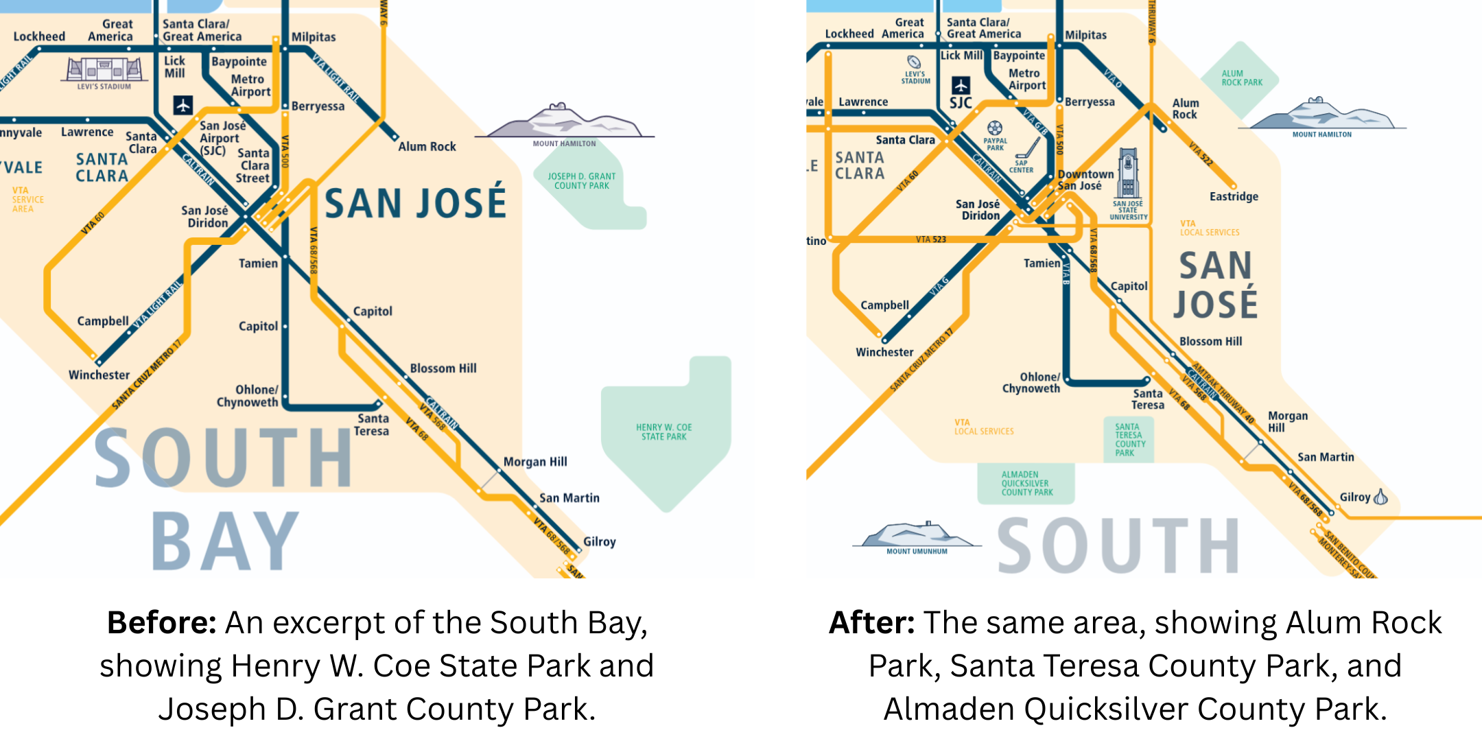
(Left) Before: An excerpt of the South Bay, showing Henry W. Coe State Park and Joseph D. Grant County Park.
(Right) After: The same area, showing Alum Rock Park, Santa Teresa County Park, and Almaden Quicksilver County Park.
A regional transit map isn’t just a way to show the most important long-distance transit routes in the area. It also shows where we live, where we work, and where we play, and lets us know we can do it by transit. Tourists looking at the map in a San Francisco BART station will be able to see Angel Island. Berkeley students will be able to see new places to explore up and down the Bay. And residents of cities around the Bay will be able to see that they can explore their backyard without a car.
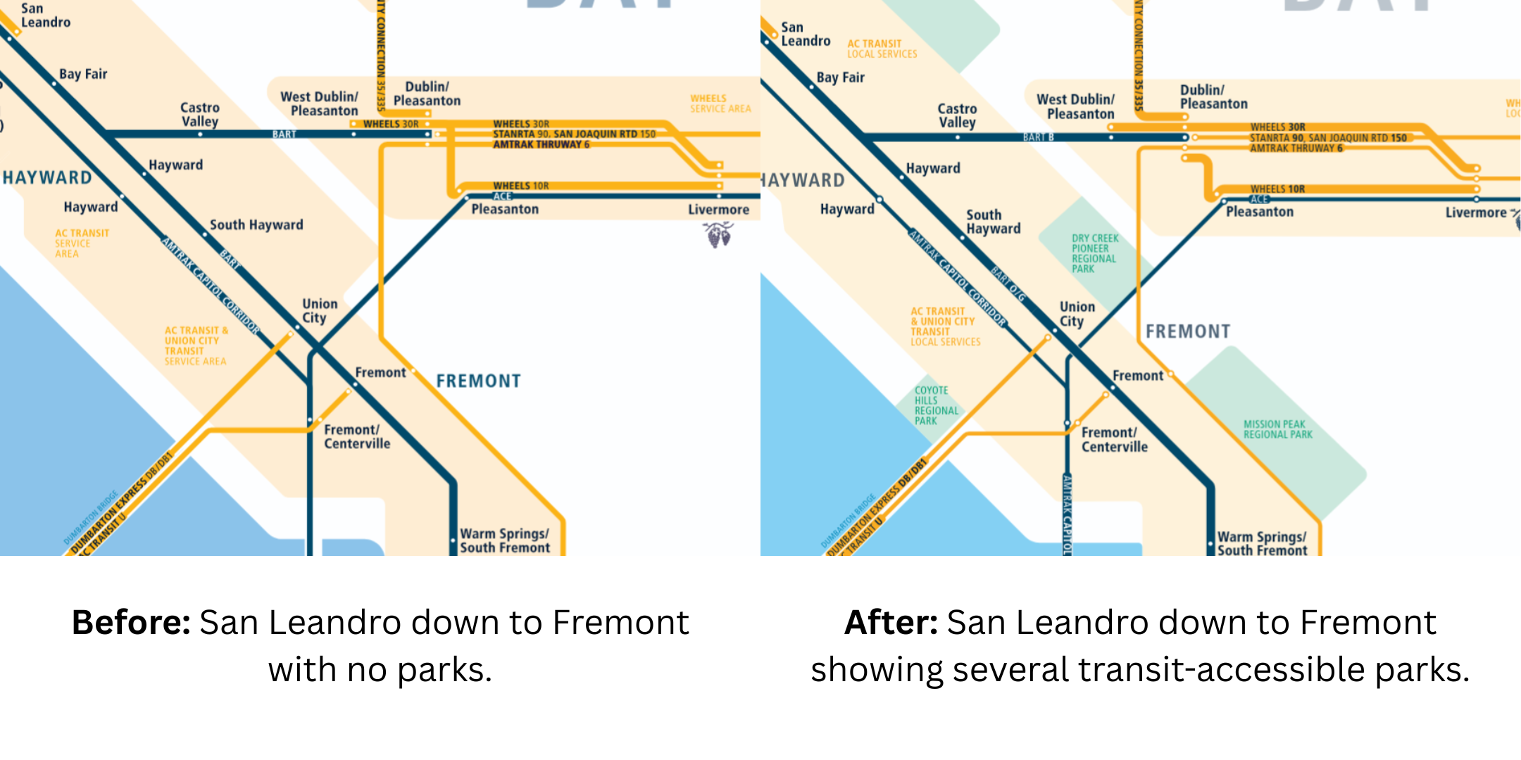
(Left) Before: San Leandro down to Fremont with no parks.
(Right) After: San Leandro down to Fremont showing several transit-accessible parks.
The Regional Mapping and Wayfinding project is about how our transit agencies communicate what they do and how they do it. With the Regional Transit Connections map, our agencies are finally speaking with one voice about how to get around the region, whether you’re going somewhere served by bus, train, or ferry. More regional communications opportunities remain: how do we show off special park routes? How can we make all-nighter travel easier? It’s exciting to be here as we collectively sketch our vision for the future of regional travel in the Bay Area.
Interested in better transit to the outdoors? Park districts around the Bay Area want to improve access. Help us help them prioritize transit – sign up for public comment action alerts and let us know your thoughts on transit access.